In the Fall 2017 Implementing Complete Streets class, I worked with a team of 3 other Urban Planning students to create a plan for Division Street around the changing Goose Island area.
Our plan, Bridging the Division, sought to develop stronger connections between the existing vibrant neighborhoods that touch Division. Improved on-street bike and pedestrian infrastructure, coupled with changes in zoning and land use around Goose Island, would make walking and biking more comfortable from West Town to Old Town.
We observed major differences in street width and configuration, land use, and non-motorized uses along the corridor. In order to best address these, we divided the project area into 4 distinct zones:
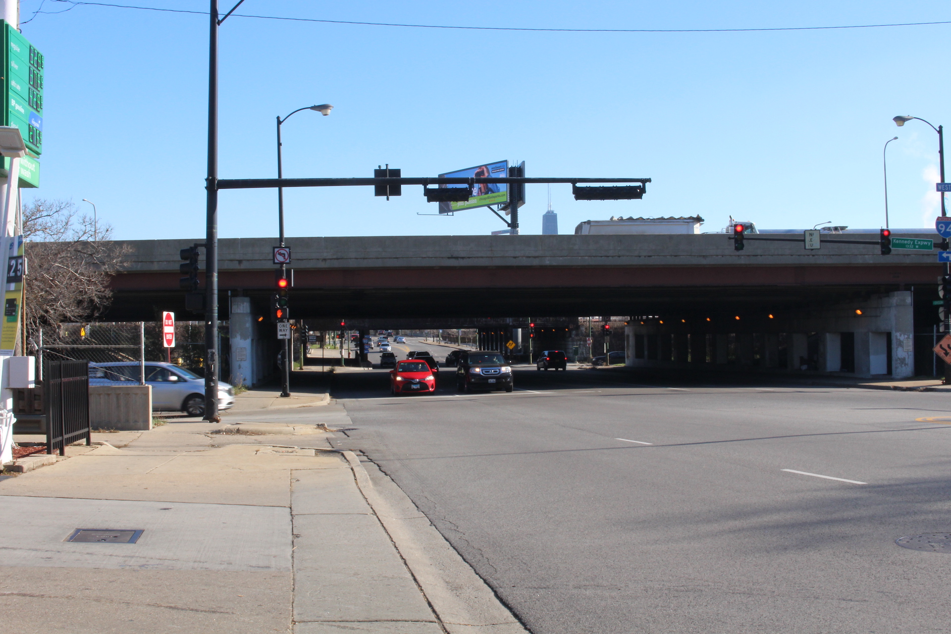
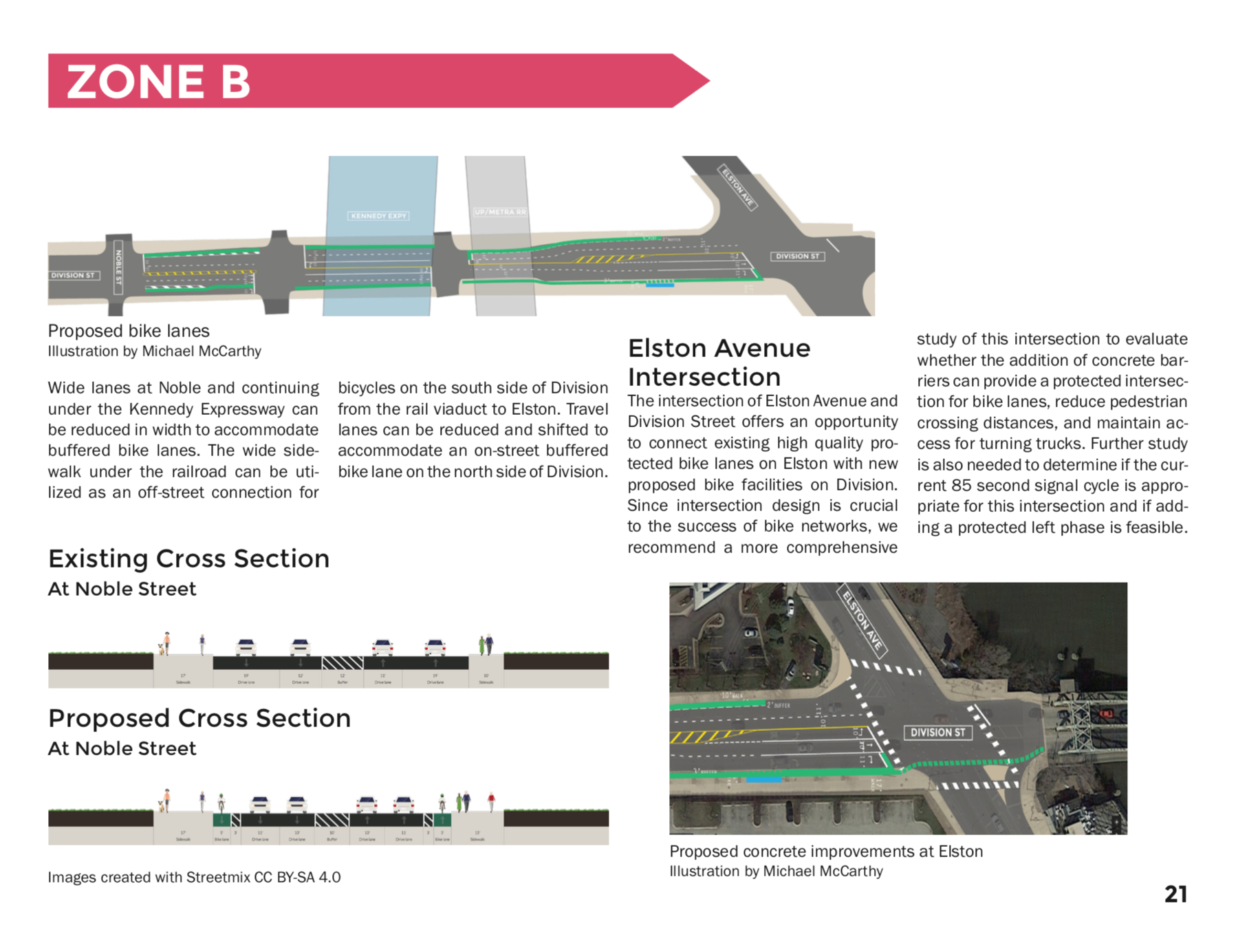
I focused on Zone B, which includes underpasses for the Kennedy Expressway and the Metra/Union Pacific North and Northwest lines (pictured below).
In our observations, many bicyclists were already using Division, which has comfortable bike lanes west of the study area. However, we also saw bicyclists using the sidewalks to get around congested segments near the Kennedy Expressway and to avoid railroad tracks on Goose Island.
Overall, we found that new bike lanes through most of the corridor could be accomodated by slimming existing wide traffic lanes. We proposed making sidewalks more comfortable by extending the Wicker Park/Bucktown Special Service Area (SSA) to add street furniture and improve maintenance of the western part of the project corridor. Over the long term, we acknowledged that a transformation of the pedestrian experience will require allowing and encouraging pedestrian-oriented land uses in the future.
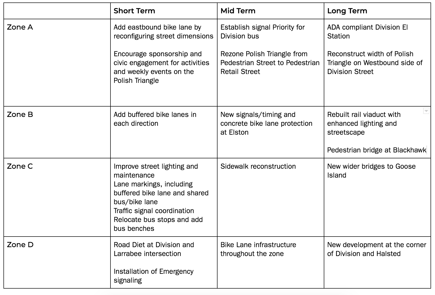
All recommendations for every zone are summarized below: