The Resilient City Plan was created by UIC Master in Urban Planning and Policy (MUPP) students in the Spring 2018 Plan-making Studio.
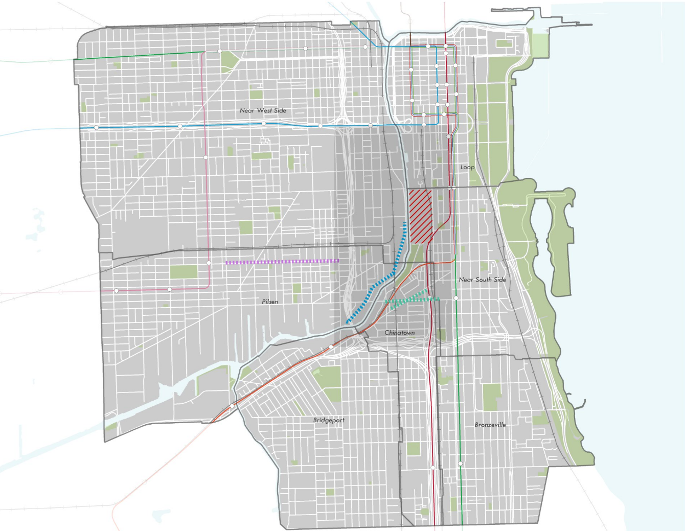
The 78 development site (near Roosevelt and Clark) and the surrounding study area
The plan looks 20 years into the future to predict and remediate negative impacts of “The 78” mega-development in the South Loop. In the context of increasing income inequality and decreasing home affordability, the plan serves as a template for preserving affected communities like Pilsen and Chinatown without rejecting new development outright. Instead the goal is to include all of Chicago's communities in the city's prosperity.
As such, the [plan document] serves as an equity plan for the communities within 64 census tracts surrounding the development site. The Resilient City Plan analyzes existing conditions, forecasts future trends, and ultimately, proposes a set of community-centric initiatives for preserving local ownership of our neighborhoods, businesses, homes and public spaces that can sustain through the year 2048 and beyond.
I was part of the Connected City team tasked with figuring out how to accommodate an influx of new workers (such as for a new Amazon HQ or other tech hub) while mitigating issues related to transportation such as parking, loading/unloading for ride-hailing and deliveries, equity in public transportation, and safe accommodations for people walking and biking through complete streets.